Maps & GIS
AvailableMap Generator
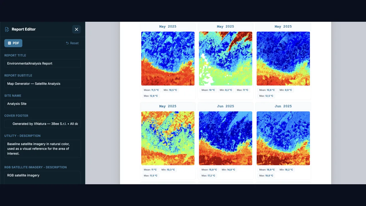
Generate professional environmental maps from 80+ Copernicus satellite layers without any GIS expertise. Draw an area on the map, choose thematic layers, and download PDF reports with AI-generated narratives and territorial KPIs.
What you can do
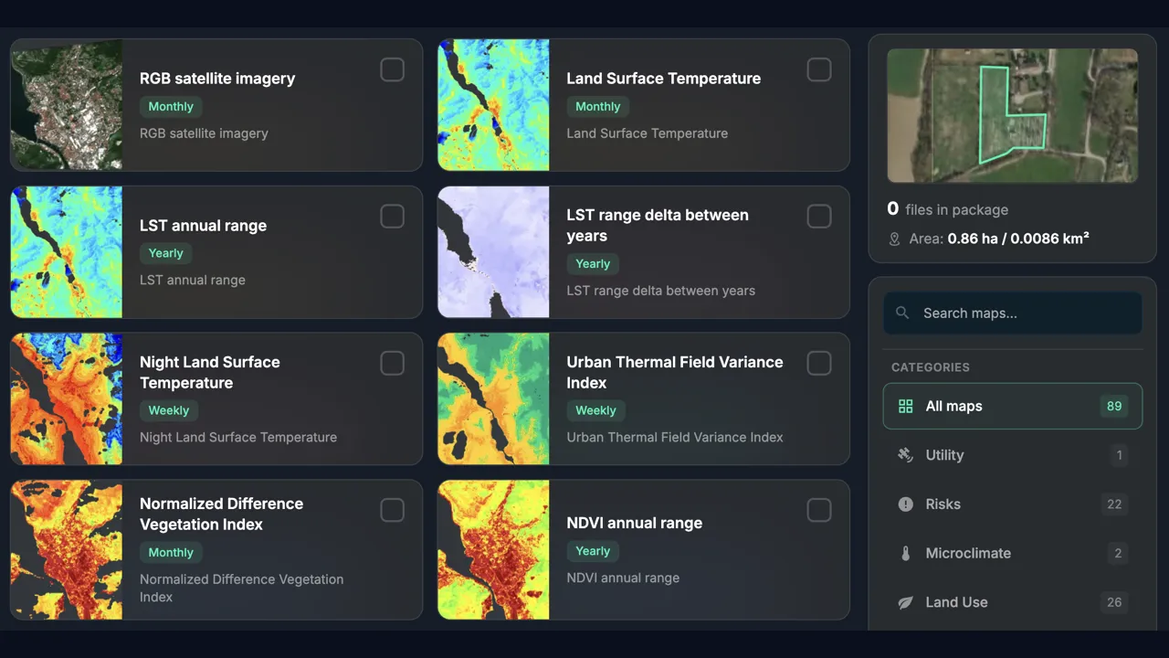
80+ Copernicus satellite layers (Sentinel-1, Sentinel-2, CLMS)
Area definition via polygon drawing or KML/GeoJSON import
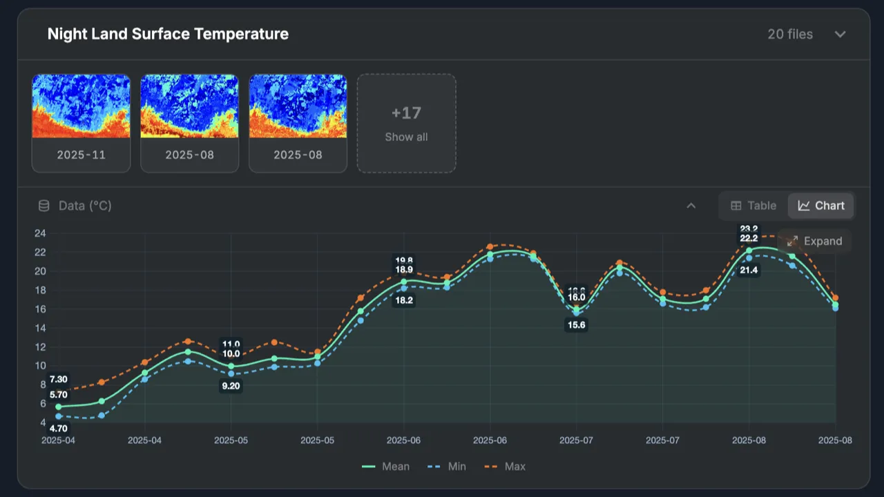
AI reports with automated narratives and territorial KPIs
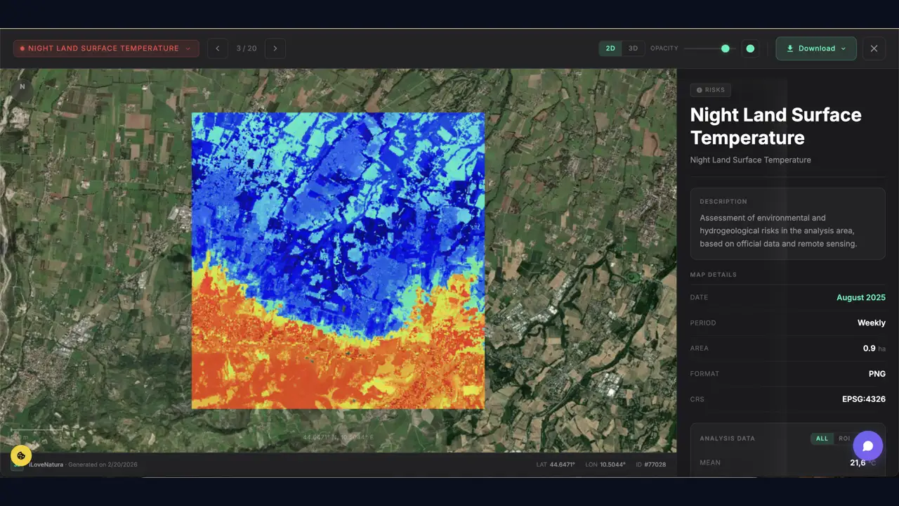
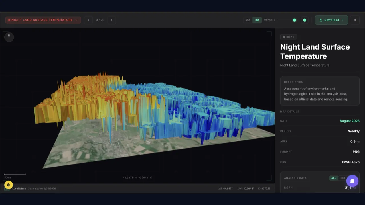
High-resolution PNG map export and comprehensive PDF reports
See it in action
Map Generator
Map Generator
Map Generator
Map Generator
Map Generator
How it works
1
Draw the area
Trace a polygon on the map or import a KML/GeoJSON file to define the territory.
2
Choose layers
Select from 80+ thematic layers: vegetation indices, land use, temperature, and more.
3
Download map and report
Receive high-resolution PNG maps and a PDF report with AI narratives and territorial KPIs.
Try it now
Free — start right away with your credits
Related tools
Explore other tools you might find useful
Comparative Temporal Satellite Maps
Comparative Temporal Satellite Maps
Compare satellite imagery across time periods to track environmental changes and land use evolution.
GIS Editor
Coming Soon
GIS Editor
Interactive GIS editor with AI-powered assistant for geospatial analysis, distance measurement, and area calculations.
Simple Web GIS Utils
Simple Web GIS Utils
Lightweight web-based GIS utilities for quick spatial analysis, coordinate conversion, and basic geospatial operations.
Complete Platform
Complete Platform
Full environmental monitoring platform with integrated biodiversity tracking, climate analysis, and comprehensive reporting.
Risk Assessment Platform
Risk Assessment Platform
Evaluate environmental risks, identify potential hazards, and implement proactive mitigation strategies for your sites.
ESG Site Scorer
ESG Site Scorer
Quick environmental ESG assessment for any location with a 0-100 score, radar breakdown across climate, biodiversity, water, soil, and air.